Engineering-grade mapping and elevation data that supports planning, design, inspection, and long-term infrastructure evaluation.
Get in TouchDrone technology has become an important tool in modern engineering and surveying. At Givler Engineering, drone mapping services are used to collect accurate site data more efficiently, safely, and consistently across large or difficult-to-access areas.
These services are not simply aerial photography. The goal is to generate engineering-grade mapping and elevation data that can support planning, design, inspection, and long-term infrastructure evaluation.
Our drone surveying and mapping capabilities support:
Drone mapping is the process of collecting aerial imagery and elevation data using unmanned aerial systems (UAS) and converting that information into usable engineering deliverables.
Depending on the project, drone mapping may include:
Drone land surveying allows engineers to evaluate large sites quickly while maintaining the precision necessary for engineering analysis.
The resulting information can then be incorporated into grading plans, floodplain studies, infrastructure assessments, and site development planning.

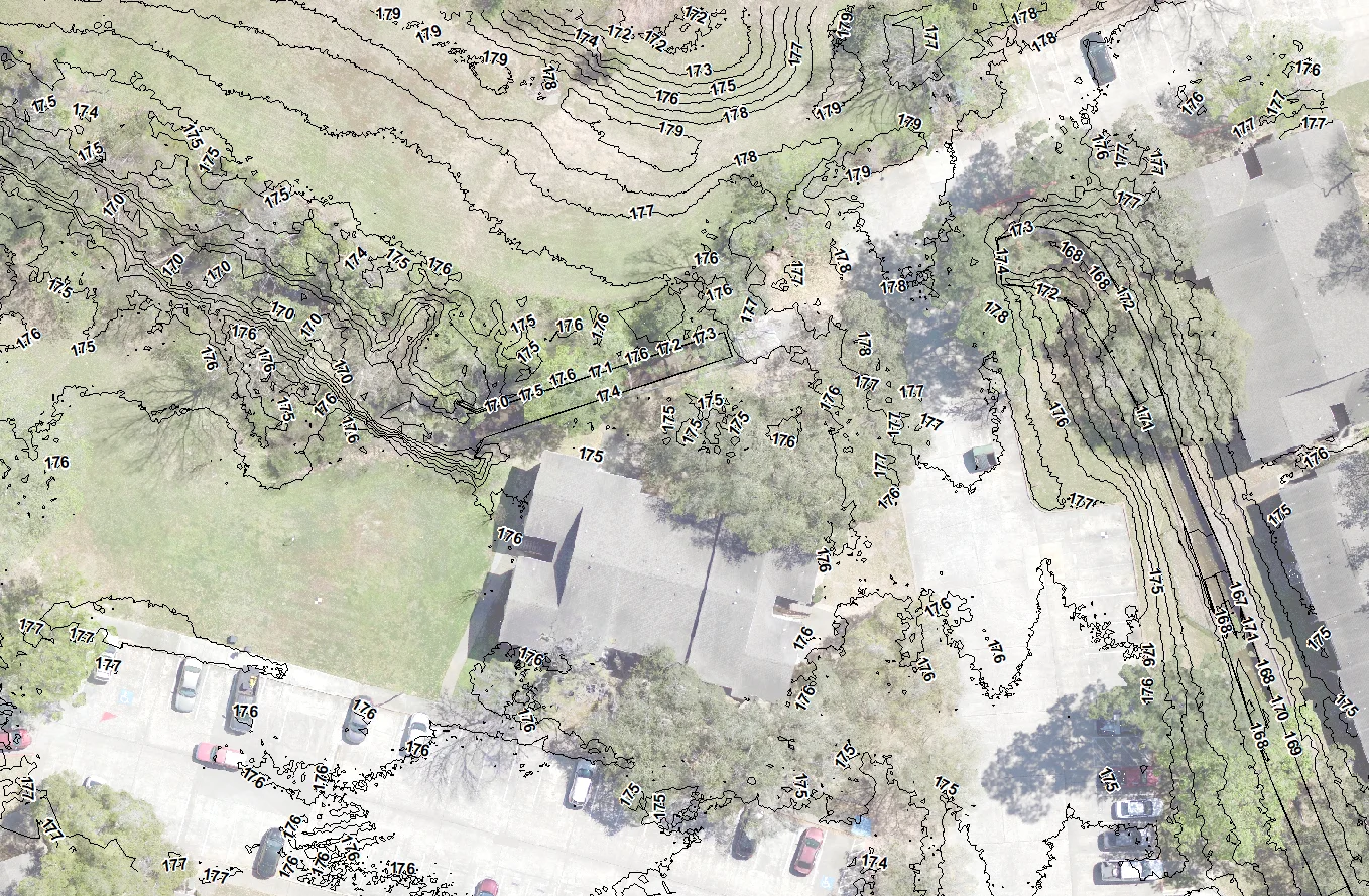
Drone mapping services are especially valuable during early site evaluation and land development planning.
Using drone surveying and mapping, Givler Engineering can generate:
Compared to traditional field-only methods, drone land surveying can improve efficiency on larger sites while still producing engineering-grade mapping data.

Drone mapping provides a safer and more efficient way to evaluate infrastructure conditions.
Drones can assist with:
Drone mapping also allows engineers to monitor infrastructure conditions over time. When surveys are tied to established benchmarks and datums, even subtle elevation changes associated with settlement or movement can be identified and evaluated.
Drone surveying and mapping is also valuable during construction.
Aerial mapping allows engineers and owners to monitor:
On large projects, drone mapping services can dramatically reduce the amount of field time required while giving engineers a much clearer view of overall site conditions.
Drone mapping services are especially valuable during early site evaluation and land development planning. Using drone surveying and mapping, Givler Engineering can generate existing conditions mapping, spot elevations, terrain models, drainage and grading information, and floodplain and FEMA-related documentation.
Drone mapping provides a safer and more efficient way to evaluate infrastructure conditions. Drones can assist with earthen embankment inspections, spillway evaluations, erosion monitoring, slope stability observations, concrete structure documentation, and difficult-to-access inspection areas.
Drone surveying and mapping is also valuable during construction. Aerial mapping allows engineers and owners to monitor earthwork quantities, cut-and-fill operations, stormwater BMP implementation, large-scale grading, and construction progress across extensive sites.
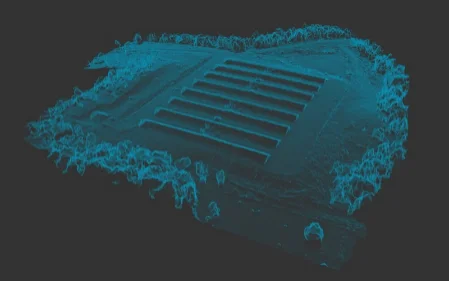
LiDAR mapping uses laser-based measurement technology to collect highly detailed elevation information.
Unlike standard aerial imagery, LiDAR mapping can often penetrate vegetation and capture terrain conditions beneath tree cover. This makes LiDAR mapping useful for:
LiDAR data can then be processed into detailed terrain and elevation models for engineering analysis.
Photogrammetry uses overlapping aerial photographs to calculate elevations and create three-dimensional terrain information.
This process supports:
When conditions allow, photogrammetry efficiently produces detailed mapping information across large areas.
One of the biggest advantages of drone surveying and mapping is accessibility.
Traditional surveys can be difficult in:
Drone mapping allows engineers to collect information in locations that may otherwise require difficult terrain navigation, extensive clearing, or prolonged field work.
It also improves efficiency. Large areas can often be mapped much faster than with traditional ground-only methods while still supporting detailed engineering analysis.
For large infrastructure sites and land development projects, that efficiency can significantly improve project planning and evaluation timelines.
Engineering drone mapping requires more than collecting aerial imagery.
At Givler Engineering, drone mapping data is tied into established benchmarks and survey control systems so conditions can be compared reliably over time.
The value of our drone mapping services comes not only from the speed and precision enabled by the technology, but from the engineering analysis that interprets and applies the data.
Drone operations must comply with FAA regulations and operational limitations.
Givler Engineering utilizes FAA-certified drone operators and coordinates projects based on:
Environmental factors such as vegetation, rainfall, and standing water may also influence the mapping method selected for a project.
Drone mapping provides engineers, municipalities, and property owners with a more efficient way to evaluate infrastructure and existing site conditions.
At Givler Engineering, drone mapping services are used as engineering tools — supporting surveying workflows, infrastructure evaluation, and long-term planning efforts.
Whether evaluating development sites, monitoring construction progress, or assessing infrastructure performance, we focus on delivering reliable data clients can use with confidence.
Need engineering-grade drone mapping for your next project? Contact Givler Engineering today to discuss your site, infrastructure, or development needs.
Contact Givler Engineering